


View looking out over the Wicklow Mountains
Most IMRA runners, orienteers and mountain bikers would be familiar with Carrick Mountain in Glenealy as a great little spot for hitting the trails. And it is!
However, it isn’t my favourite place to run trails in Glenealy. I’m going to let you in on a little secret…
There’s a much nicer trail through the deciduous trees and wildflowers of Deputy’s Pass. I’ve also encountered the elusive Pine Marten and red squirrels in this area.
It doesn’t really matter which way you start this Figure of 8 trail, but when you reach the junction of the main loop with another (gently upward sloping) trail, take this one (otherwise you’ll end up back at the carpark far too soon!).
You’ll soon approach another junction, this section is often muddy, made more so by equestrian users who sometimes use the field ahead on your left for their horses to graze. Deer are sometimes grazing here too – it is Gleann Fhiaidhle after all….
Ignoring the right turn (dead end into a field), take the narrowing trail ahead of you. Edible navelsworth/pennysworth sometimes adorn the old stone wall. This trail widens again at another junction. Turn right here onto another upwardly sloping narrow trail which again widens out at farmer’s gate. The views of distant hills are already starting to unfold.
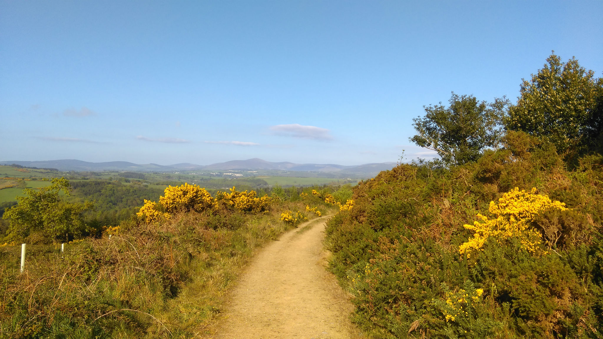
Run down the dirt road and just before you reach the house, duck left into the ditch onto a windy track. This leads you on to a wonderfully aromatic, gorse-lined route up to another spot height where you can pause to appreciate the scenery.
From the spot height, run down the forest track, taking the first left, turning left again at the next junction. This will lead you back uphill. Follow this to the brow of the hill, but when you are close to the top, keep your eyes open for a narrow track on your right. Take this route back to where you enjoyed the scenery not too long ago! It looks like there is the option of continuing straight on here, but this peters out after a short distance.
Return to the main Deputy’s Pass Loop Trail via the same route and complete the rest of the loop back to the carpark.
Route suggested by Cindy Doyle. www.GoWild.ie
Distance & Climb:
- Distance: around 9km
- Total ascent: 159m
- Maximum elevation: 216m
Start GPS:
- GPS FOR START POINT: 52.948138, -6.164286